Overview
Hinge context. V3.1 established planetary-scale intentionality (pyramid→MHO alignments). V3.2 revealed star-fort geometry + hydro-engineering as an adaptive geodetic infrastructure. V3.3 merges these into an operational claim: architectural nodes encode planetary mechanics across crust, atmosphere, and hydrosphere, measurable via standard climatology/crustal-physics datasets.
Objectives
- Lay a defensible climatology + crustal physics baseline for Codex overlays.
- Integrate multi-proxy dating (“Earth’s memory technologies”) to time-lock events.
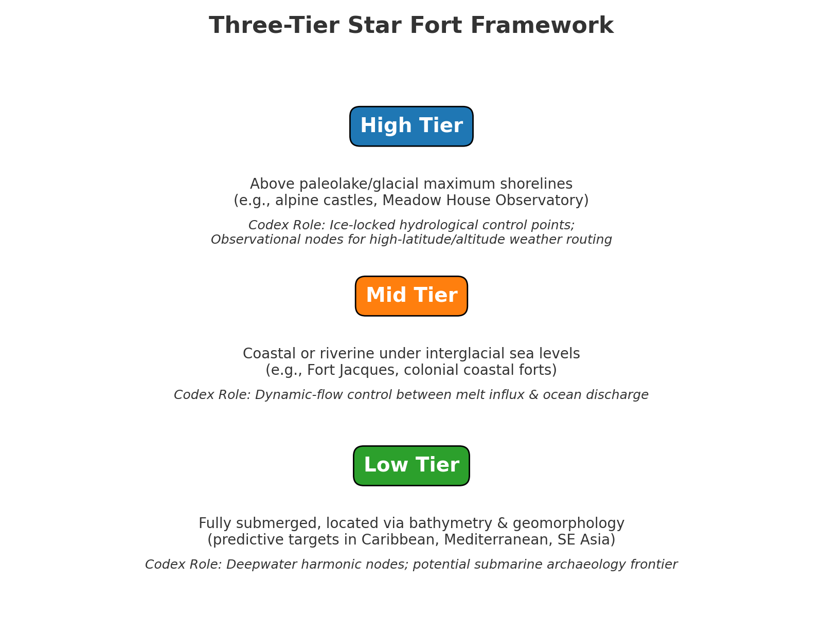
- Define and test the Three-Tier Star Fort Framework (high/mid/low elevation bands) against paleohydrological models.
- Produce an operational resonance map that couples crustal stress, atmospheric circulation, and hydrological flow to architectural nodes.
Data Inputs
- Geodesy: GNSS/GPS site coords for pyramids, star forts, megalithic observatories (CSV/KML/KMZ).
- Topography & Bathymetry: DEM/DSM (SRTM/ASTER/ALOS), GEBCO/ETOPO1, coastal geomorphology shapefiles.
- Paleohydrology: paleolake shorelines, glacial extents, meltwater routing (regional literature + raster reconstructions).
- Atmosphere/Ocean: reanalysis (ERA5), jet/Trades climatologies, ENSO/PDO indices, AMOC proxies.
- Proxies & Isotopes: ice cores, varves, speleothems, corals, loess; radiogenic systems (Rb–Sr, Sm–Nd, U–Pb); radiocarbon & tephra markers.
Methods
- Temporal locking: align event layers via proxy cross-calibration; record uncertainty windows.
- Spatial registration: project nodes onto DEM/bathymetry; compute elevation bands relative to regional paleoshorelines.
- Harmonic overlay: compute inter-node spacing/azimuths; test resonance against atmospheric cell boundaries and meltwater corridors.
- Tier classifier (star forts): assign High (above paleoshore), Mid (coastal/riverine interglacial), Low (fully submerged, predictive) with rule-based logic + optional ML refinement.
- Stability scoring: derive node scores using ChiRhombant-style v·h² components (proprietary coefficients withheld); output corridor-level stability indices.
Earth’s Memory Technologies — Method Matrix
| Method / Archive | Material | Resolution | Codex Outcomes |
|---|---|---|---|
| Dendrochronology | Tree rings | Annual–millennial | Drought/flood frequency; volcanic aerosol signals |
| Varve analysis | Lake sediments | Annual–10 kyr | Meltwater pulse timing; seasonal shifts |
| Ice-core isotopes | Polar/glacial ice | Annual–800 kyr | T/CO₂; tephra; impact ejecta layers |
| Speleothem δ18O/δD | Cave calcite | Decadal–500 kyr | Precipitation/monsoon reconstructions |
| Coral banding | Reef corals | Annual–centuries | SST & salinity variability |
| Loess / aeolian | Wind-blown silt | Decadal–Myr | Dust flux; aridity cycles |
| Rb–Sr / Sm–Nd / U–Pb | Crustal minerals | Myr–Gyr | Orogeny & uplift timing; crust–mantle mixing |
| 14C | Organics | Up to 50 kyr | Event dating for cultural/ecosystem layers |
| Tephrochronology | Volcanic ash | Annual–Myr | Eruption correlation horizons |
These archives are layered and projected onto the geodetic network to produce a temporal–spatial resonance map.
Three-Tier Star Fort Framework
| Tier | Elevation Context | Example Sites | Codex Interpretation |
|---|---|---|---|
| High | Above paleolake/glacial maximum shorelines; alpine & paleo-shore observatories | Meadow House Observatory (USA), alpine castles | Ice-locked hydrological control; high-alt/lat weather routing nodes |
| Mid | Coastal/riverine under interglacial sea levels | Fort Jacques (Haiti), European coastal forts | Dynamic-flow control between melt influx & ocean discharge |
| Low | Fully submerged; bathymetry + coastal geomorphology | Predictive targets: Caribbean, Mediterranean, SE Asia | Deepwater harmonic nodes — submarine archaeology frontier |

Outputs
- Resonance Map: node–system coupling layers (crustal strain, moisture transport, aquifer discharge).
- Tiered Star-Fort Catalog: high/mid classifications + low-tier predictive targets with confidence scores.
- Stability Scores: corridor/node stability using ChiRhombant-style v·h² terms (coefficients withheld).
- Reproducibility bundle: data schema, scripts, and uncertainty notes (links below).
Validation & Reproducibility
- Cross-validate dates across proxies; propagate uncertainties into resonance timelines.
- Blind-test tier classification on hold-out regions; compare against known paleoshorelines.
- Run Monte Carlo site shuffles to confirm overunity of node alignment densities vs null models.
Links: see repository scripts and datasets referenced from the Peer Review page (Materials & Attachments → V3 Functional Details).
Forward Bridge
V3.3 closes the gap between archaeology and applied geophysics. With the climatology/crustal physics baseline and the dating matrix in place, harmonic overlays become an operational map. The three-tier star-fort model functions as a kernel within a planetary OS for predictive hydrology and environmental stabilization—origin-agnostic, fully replicable.
Next: V3.4 Crustal Tectonics (functional spec) — coupling orogeny/uplift timing with node network geometry.
Last updated: Last updated: 6/1/25