*** NEW RELEASE: Canonical Framework Lecture ***
A longform lecture presentation outlining the ADDS framework, Geodetic Codex systems architecture, hydrological corridor logic, AI-assisted anomaly detection, statistical methodology, and planetary chronometer modeling.
Modeling the ADDS Canonical Framework into a Lecture (140 min.)
Hosted at Speechify presently hereOriginally developed as a synthesis and stress-test of the broader canonical framework prior to adaptation into the Season 1 episodic series.
Based on the ADDS Canonical Framework v1.2
Podcast Series: ADDS & Geodetic Codex
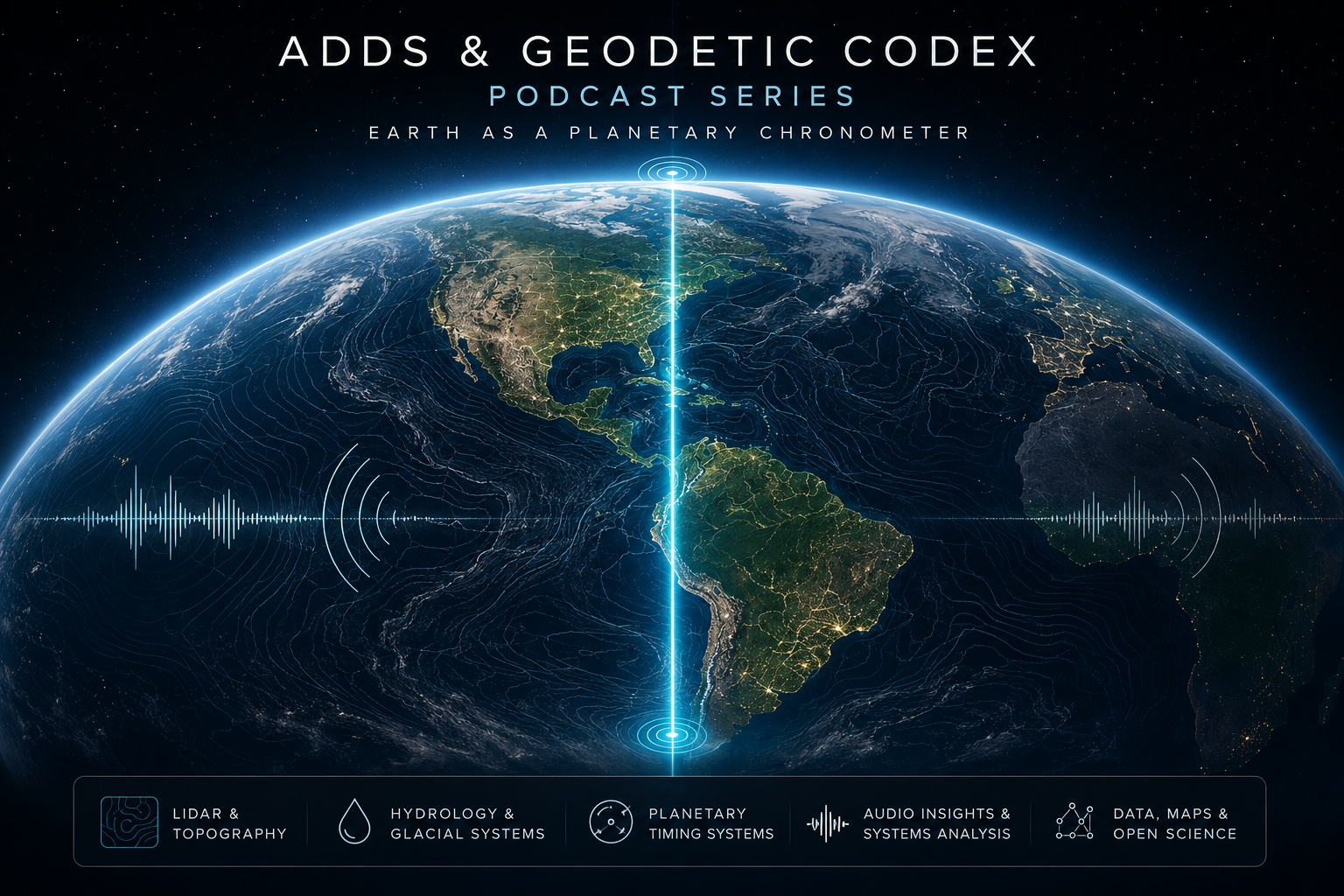
A public audio series translating the Geodetic Codex, ADDS framework, glacial hydrology, planetary timing systems, and future habitability research into accessible episodes for independent review and public science communication.
🔬 Research Transparency: Visuals & Manuscript

Neutrinos and the Architecture of Consciousness
A theoretical dive via exploratory paper linking neutrinos, geophysical structure, and the Hermetic idea of “as above, so below” into a single framework for thinking about consciousness. It does not claim new physics; instead it treats established particle and cosmology results as boundary conditions and asks what kinds of consciousness models fit inside those constraints,
treating neutrinos, geology, and consciousness as parts of a single constraint‑first intelligence framework.
The work builds on the Geodetic Codex and ChiR Labs research into planetary memory systems and pioneering anomaly detection (ADDS) modeling.
It is written for people who care about both cosmology and applied systems—scientists, designers, and strategists working at the edge of AI and earth systems. Feedback, critique, and collaboration proposals are welcome via issues or direct contact.
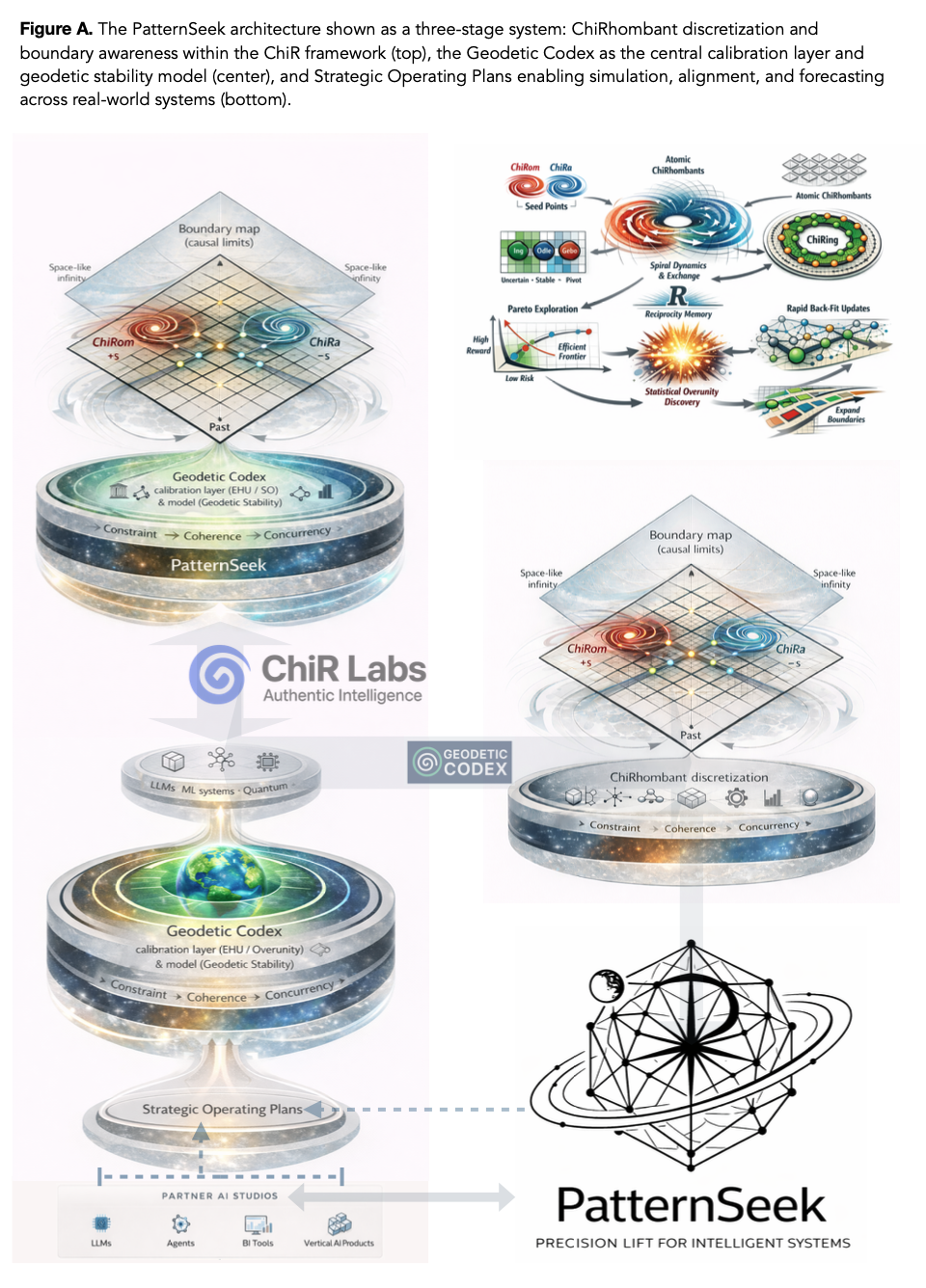
PatternSeek (w/ GeoCodex core) & ChiR v4 here
***NEW RELEASE: Planetary Chronometers v2.2:***
***Companion v2.3 Chronometer Layer Siting Heuristics***
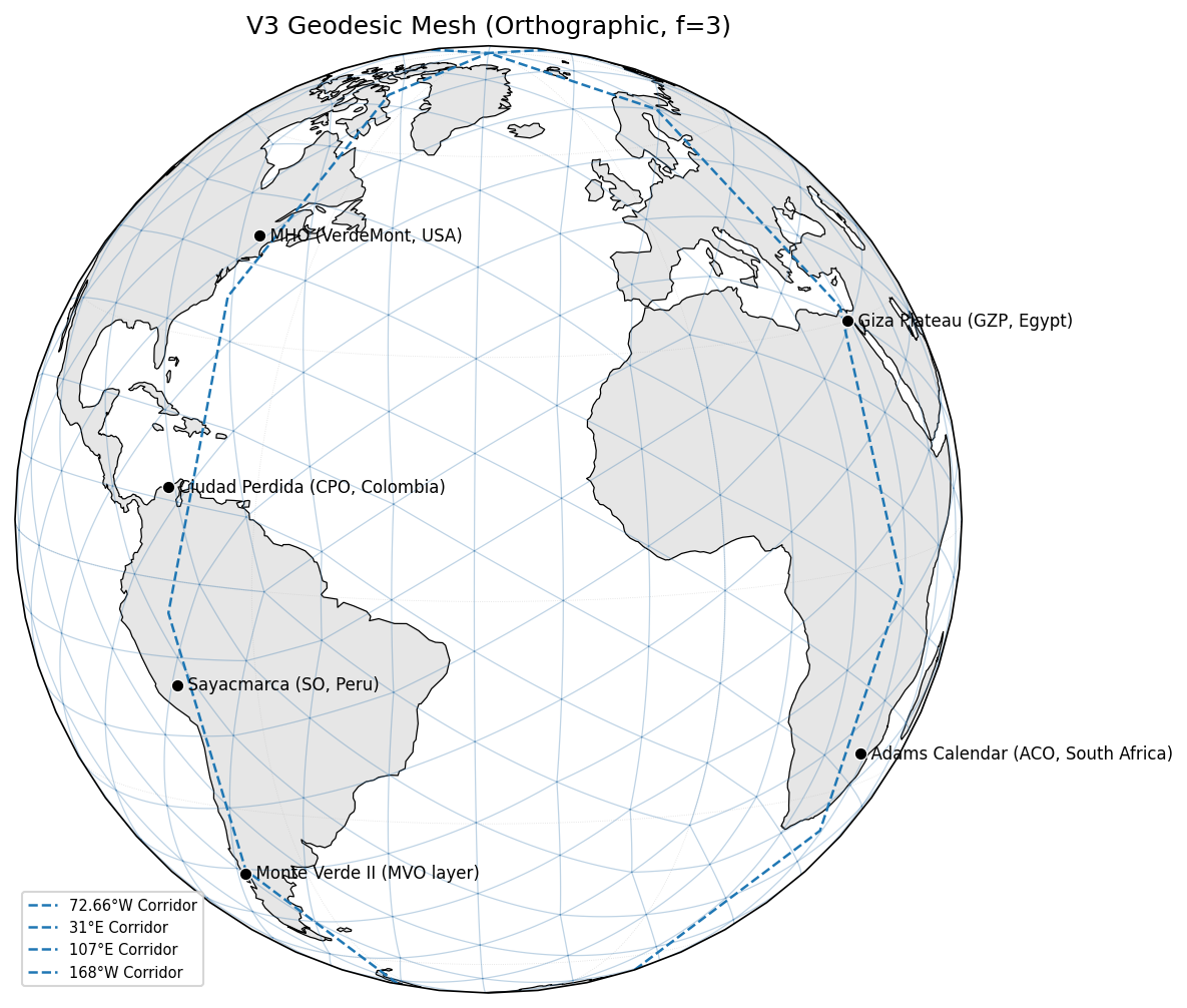
The following are a quick PDF journey from geomagnetic pole-to-pole along the 72.66° West of Longitude line (Axis Mundi), the manuscript (v.3.2 latest), and high resolution visuals from the manuscript and related addendum:
Pole-To-Pole Research Overview →
Includes Rainforest Fulcrum Addendum on Page 42. as entered via Kaggle in the OpenAI to Z Challenge Research findings use OpenAI models to discover previously unknown archaeological sites (though abstract planetary modeling).
Rainforest Fulcrum Addendum (LiDAR fieldwork, proof of method)
Visuals From the V3.1 Manuscript & V3.2 Including the Rainforest Fulcrum Addendum
🔍 GeoCodex Versioning Roadmaps & Functional Specs
Click a row to expand its subsections and links.
Version 3: Geodetic Foundations & Planetary Forensics
- V3.1 & V3.2 research PDFs (statistical and narrative core)
- Walkthrough videos, maps, and overlays
- Version 3.3: Functional Spec - Climatology / Meltwater
- Version 3.4: Functional Spec - Crustal Tectonics
- Version 3.5: Mineralogical Reservoirs — Composition, Distribution, and Harmonic Coupling
- Version 3.6: Functional Spec - Hydrology–Tectonic Coupling
- Version 3.7: Functional Spec - Orbital Mechanics & Long-Cycle Hydrodynamics
- Version 3.8: Functional Spec - Energy Systems
- Version 3.9: Functional Spec - Taxonomy & Intelligence
- Version 3.10: Functional Spec - Extinction Models
Version 4: Planetary Harmonics, Hydrological Memory, and Resonant Intelligence Layer Details
- V4 (Release Notes) → New Codex Corridor Nodes Now Statistically Validated as Observatories
- V4 Kaggle notebook (living model, datasets, scripts)
- V4.1 – Glacial Meltwater Pulse Dynamics
- V4.2 – Harmonic Watershed Resonance
- V4.3 – Subterranean Water & Memory Encoding
- V4.4 – Submerged Vectors & Torsional Release
- V4.5 – Solar Flare Coupling & Quartz Resonance
- V4.6 – Fire, Ice & Meltwater Ignition Systems
- V4.7 – Subterranean Channels and Terraforming Logic
- V4.8 – Bathymetric Inversion & Lost Altitudes
- V4.9 – Phase Transition Reservoirs & Terraforming Echoes
- V4.10 –Quartz Logic & Georesonant Ignition
- V4.11 – Kinetic Tools & Flow-Based Stoneworking
- V4.12 – Crustal Memory & the Georesonant Archive
V5 — Plasma, Resonance & Advanced Hydrology
Planetary Chronometers v2: Lithologic Timing and Deglacial Synchrony Across Quartz-Rich Terrains
- V5.1 — Plasma Fields & Resonant MHD
- V5.2 — Field Memory & Piezoelectric Feedback
- V5.3 — Castles, Aqueducts & Resonant Water Logic
- V5.4 — Glacial Mechanics & Cryogenic Harmonics
- V5.5 — Planetary Terraforming & Polyhedral Portability
- V5.6 — Harmonic AI Systems & Fractal Sync
- V5.7 — Resonant Planetary Ethics & Sovereignty
V7 — Harmonic Infrastructure & Civilization Templates
V8 — Collapse, Rebirth, & Tuning Events
V9 — Tectonic Resonance & Celestial Mechanics
V10 — Symbolic Systems & Archetypal Codex
V11 — Animism, Entheogens & Sonic Mind
V12 — Ritual Protocols & Harmonic Stewardship
V13 — The Harmonic Scriptures
🔭 Observatories & Geodetic Codex Nodes
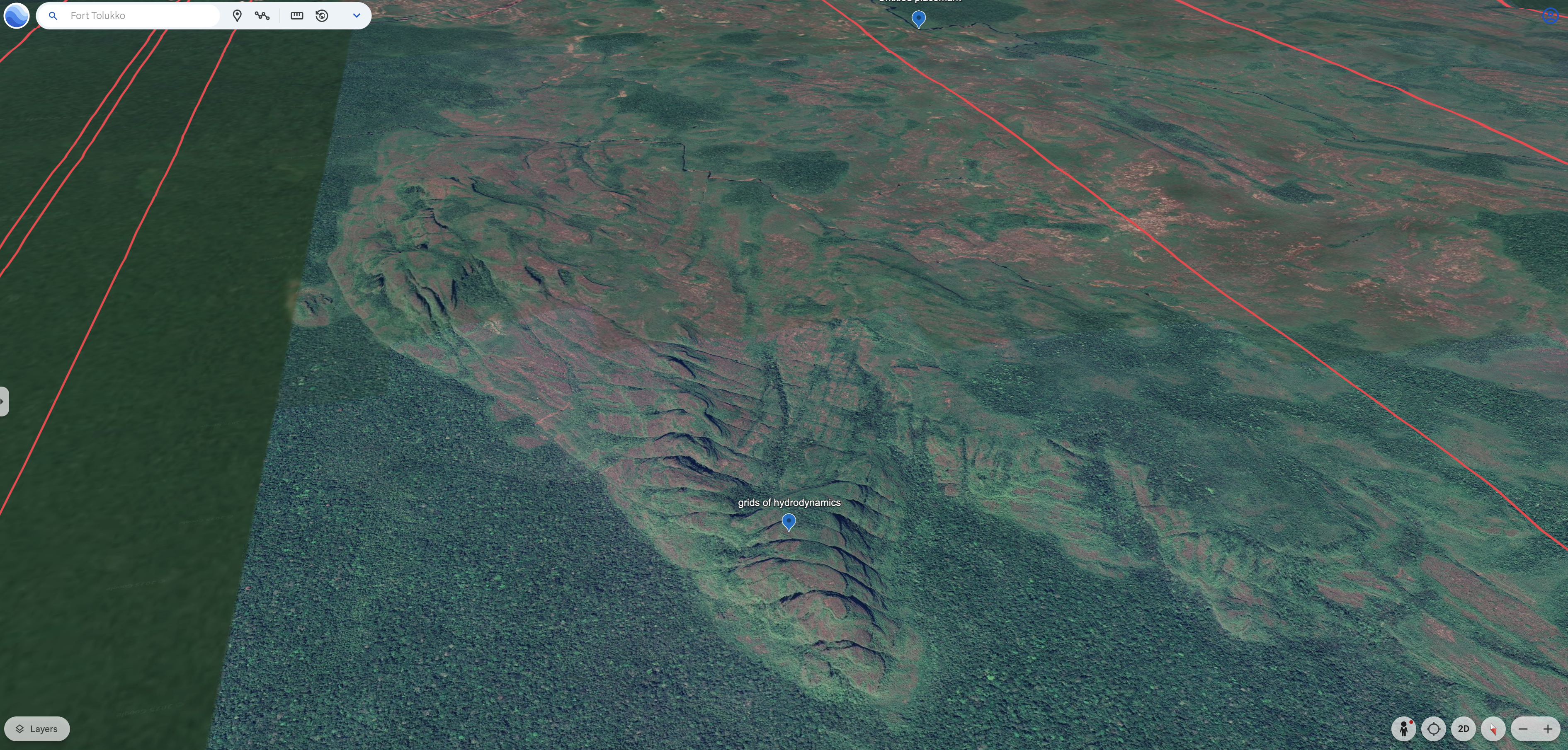
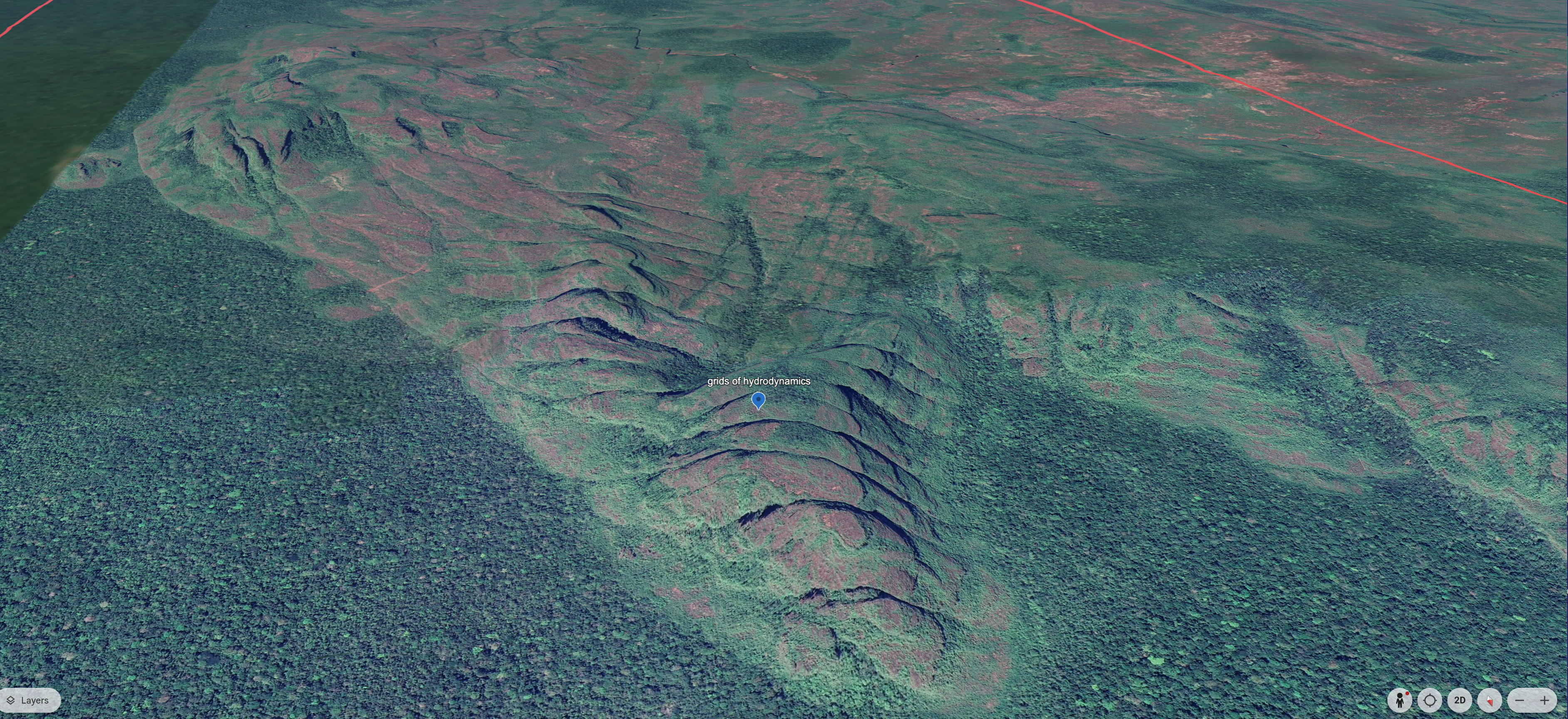
Hydrodynamics Grid of Forcation
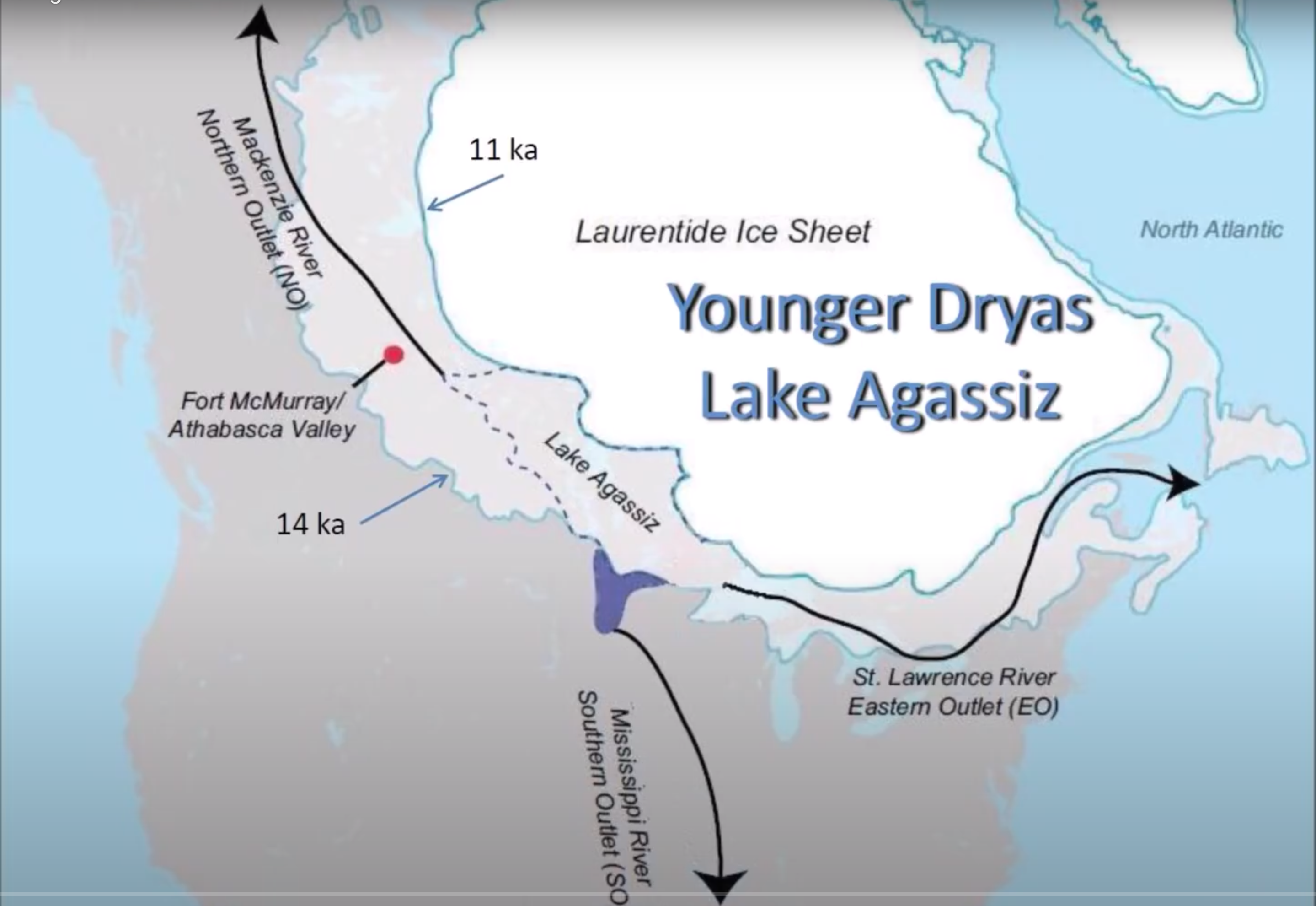
Calibrating NYC Star Fort Alignments To Glacial Ice Meltflows →
This focuses on the potential drainage impacts of Glacial Lake Agassiz across time and locally, 14,000 years before present when Glacial Lakes Winooski and Hitchcock were up at 1150' above current sea level- at MHO in Vermont and the Northeast. The Winooski river sits between 200' to 500' now for referrence.
📐 The following are the publicaly available assets for peer review & project reproducibility:
ChiRhombant Constant Calculator Demo→ AI-integrated & fully functional shortly!
🧠 Supporting PDF's for Modeling & Database Management
A41 Node Addendum → Chiribiquete Amphitheater Hydrodynamic Pattern Recognition Study→
Tetrahedral Earth: "3-Up; 1-Down" Geodetic Framework →
Data & Code Availability Statement
Data Tiles Used Along The Corridor
72.66° Corridor as the Spine of an Evolving Paleoshoreline Triangulation Hypothesis
Still requiring further calibration to all mapped Star Forts, Pyramids, and Megalithic Structures.
📄 Python Scripts & KML Downloads
3up; 1-down Geodetic Codex Modeler Python Script
Star Forts, Pyramids, Megalithic Observatories... Oh My.. Monte Carlo Simulation Download Here
72.66 Degree Corridor Monte Carlo Python Script Download
V2 & V3 Geodetic Codex Mixer KMZ (Files need naming management work)
V2 & V3 Geodetic Codex Mixer KML(Files need naming management work)
🌍 Lidar, Field Photos, & Node Details
Models and Links
1. Images of the geospatial modeling of the GC (v2)
2. An archeo-astronomers’ compass across time and space
LiDAR, Ground Penetrating Radar, and slope / elevation hotmapping from magnetic North Pole to magnetic South Pole along the Axis Mundi
3. S. America fly-through along the Corridor
4. Greenland / Canada fly-through along the Corridor
5. America / Vermont / Worcester Range / Meadow House Observatory
6. MHO: South Mound Observatory Station
7. 300+ Global Star Forts Plotted to the Geodetic Codex in V3.2
8. Corridor Validation: LiDAR, Fieldwork & Artifact Rebuttal
See also: Anomalies Addendum: Tortuga & Puyuhuapi — a supplement to this Kaggle notebook on corridor validation and this one on LIDAR integrity and geospatial analysis.
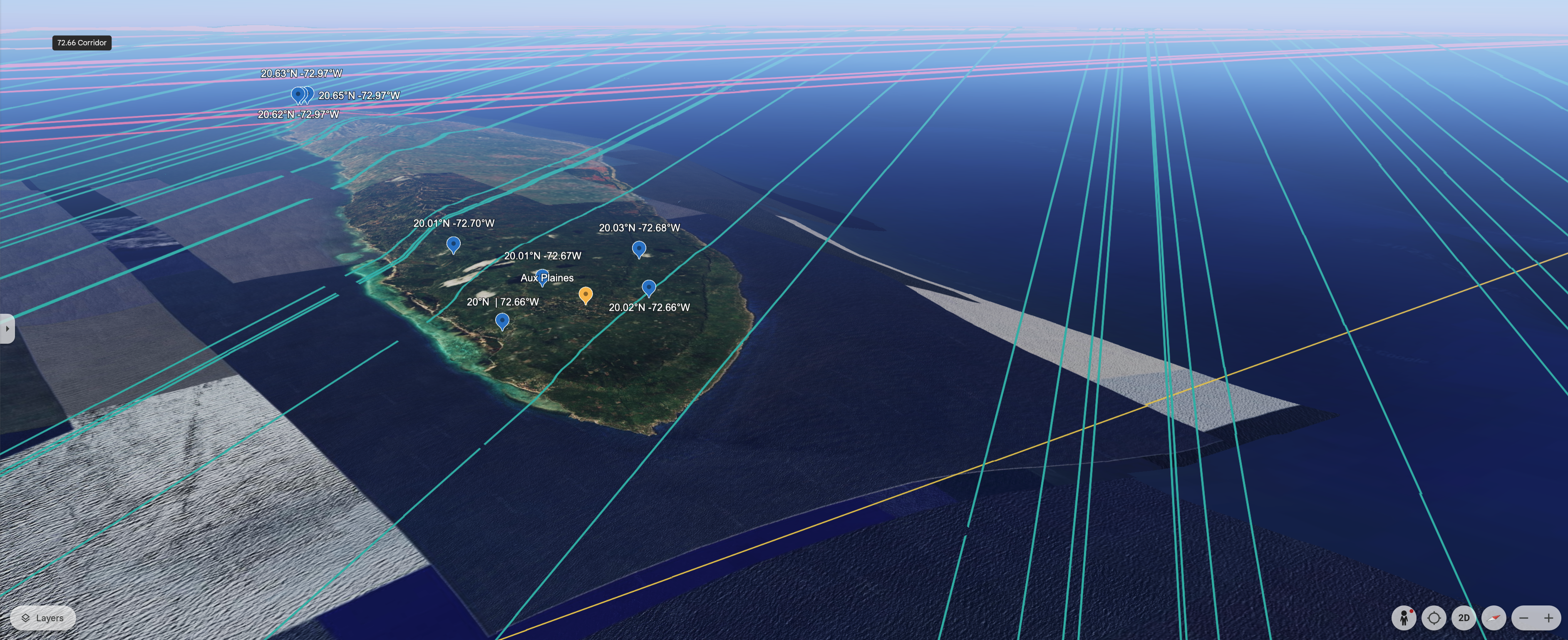
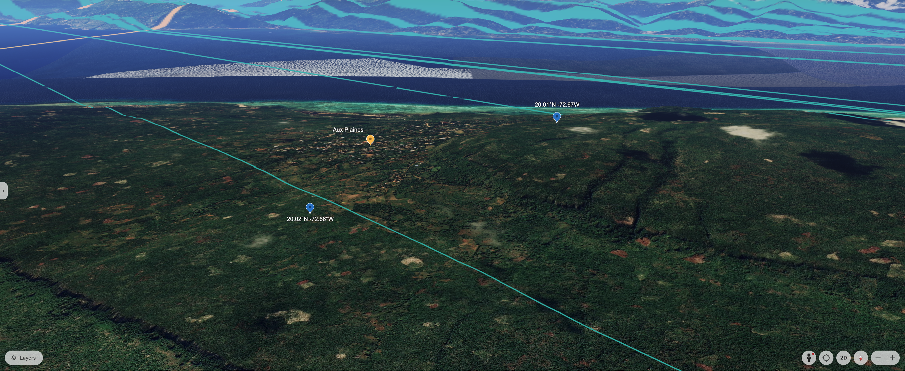
**Figure: Tortuga Peninsula Elevation Context**
Left: Steep embankment near 72.66°W using 0.01° longitudinal offset.
Right: Broader elevation profile showing consistency with natural terrain transitions.
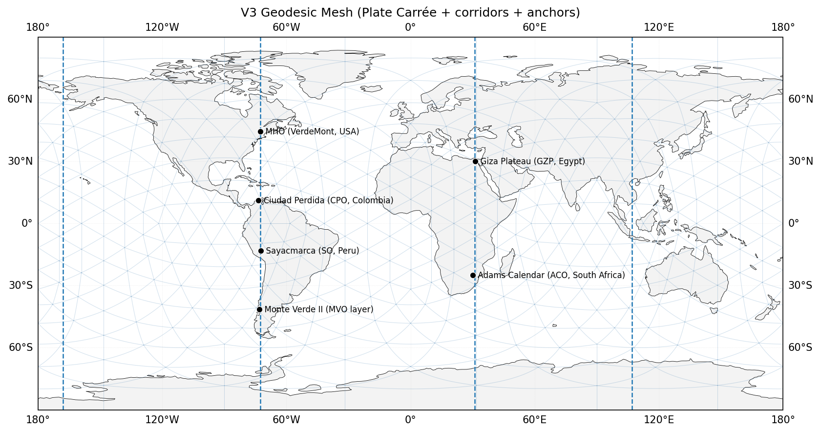
Pyramids used in the statistical modeling of the Geodetic Codex
Pyramid Sites (8 of 8) : Theoretical Calibrations on Statistically Validated Vectors
From Meadow House Observatory (MHO), USA; Citadelle Laferrière (CLO), Haiti; Sayacmarca, Peru (SO) With Local Calibration Theories at Pyramid & Star Fort Site levels
Where MHO = Yellow, CLO= Teal SO = Red; MHO→Egyptian Pyramids- Purple; MHO→ Sudanese Pyramids- Light Purple; MHO→ Europe- Gray to Blue; MHO→ Gunung Padang Region, Karyamukti, Indonesia- Green; MHO→ Mound Sites- Brown
🧮 ChiR Calculator Demo
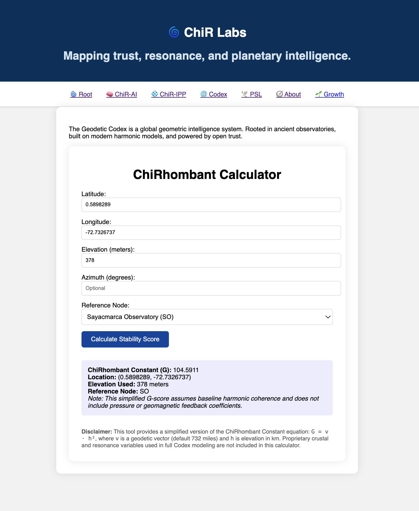
ChiR Calculator Demo → Step 1: Choose a site
This Demo uses a location in Chiribiquete National Park, Solano, Caquetá, Colombia
(clickthrough for larger image).
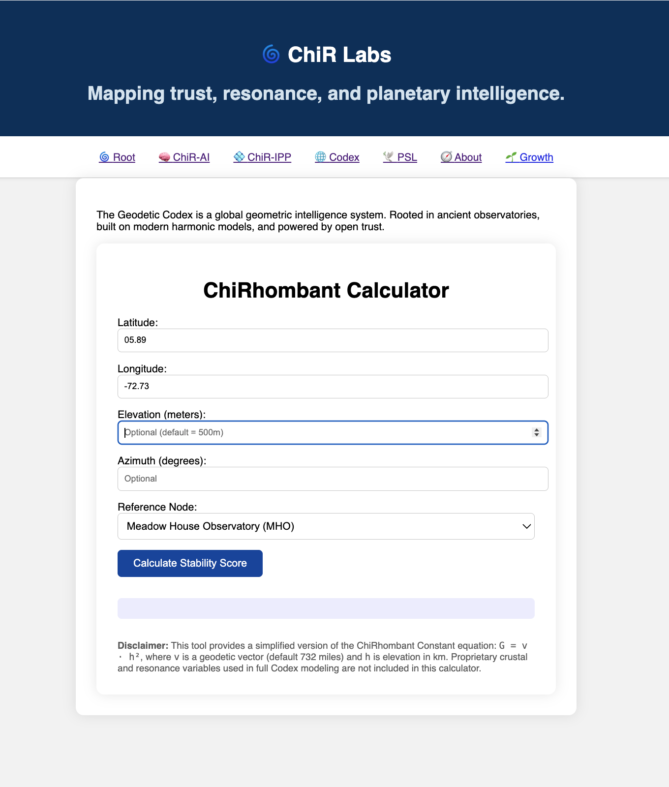
Step 2: Enter GPS Coordinates
Step 3: Enter Elevation (optional)
Step 4: Enter Azimuth (optional)
Step 5: Choose a Reference Node
Step 6: Click "Calculate Stability Score"
Wikipedia background on Chiribiquete National Park & local petroglyphs here
🌐 UNESCO Sites and Monte Carlo simulation sets
Site lists
📘 Additional Research Papers & Partner Resources
Read me file...
UNESCO World Heritage Mapping Project
🫱🏽🫲🏽 Peer Review Directory
Read me file...
🧠 ChiR-AI: Computational Assisted Modeling
Declaration Statement of Financial Interests & use of AI and computational modeling
ChiR Links:
Published- 6/5/25
Published- 6/5/25
The 3 Pillars of the ChiR Framework
Published- 11/26/24
ChiRhombant is Time Travel Ready-
Published- 11/28/24
Published- 12/2/24
Bridging Applied and Theoretical Physics in the ChiRhombant Framework
Published- 12/8/24
The Math, Physics, & Reciprocity behind ChiR
Published- 12/15/24
Published- 12/23/24
Advancing Kepler’s Triangle and Cartesian Grids
Published- 12/25/24
For Journal Article for Nature and Physics Letters (visuals & citations in preprint):
Published- 12/27/24
ChiR as a Catalyst for Multidimensional Integration
Published- 12/28/24
Published- 12/31/24
Pulse Framework As An Evolution in 3 Parts: Published- 1/25/25
Published- 1/30/25
Author: Glenn Andersen | OpenAI O1P, GPT4o & Perplexity
Published- 1/30/25
Author: Glenn Andersen | OpenAI O1P
Published- 1/30/25
ChiRhombant Framework (ChiR)
Author: Glenn Andersen | OpenAI GPT4o
Published on- 1/30/25
CROSS-VALIDATING THE MODELS & EXPANSIONS INTO HARMONIC INTELLIGENCE
Proofing Ancient Civilizations had Intelligence Beyond Current Levels of Understanding
Author: Glenn Andersen | OpenAI 4o|O1P|O3
Published- 2/5/2025